
We are looking for the next Open Quaternary Social Media Editor. All infos below & at openquaternary.com. Application deadline 19 December 2022.
We look forward to hearing from you!

We are looking for the next Open Quaternary Social Media Editor. All infos below & at openquaternary.com. Application deadline 19 December 2022.
We look forward to hearing from you!
Lay summary authored by Justyna Miszkiewicz. Read the full paper here: http://doi.org/10.5334/oq.117
Histology is the study of microscopic structure of biological tissues, and typically involves extracting a small piece of tissue, processing it into a thin slice (about 0.1 mm), and then shining a light through it using an optical microscope. While mostly needed in hospitals to examine biopsies, we can also apply histology to bone from archaeological and fossil animals, including humans.
Palaeontologists and archaeologists can find bone histology to be very informative. In adult cortical bone (the thick bone wall that surrounds yellow marrow in long bones such as the femur) they can observe longitudinal structures called (secondary) osteons which form as a result of bone metabolic processes. When alive, our bones actively remodel meaning that they replace old bone with new bone to ensure bone strength and health. Amongst other factors, these osteons accumulate with age and physical activity. Because bone microstructure is sometimes well preserved in specimens spanning the Quaternary period, characteristics of these osteons can be examined to reconstruct remodelling in animals from the past.

A common approach in this type of analysis is to measure the area and density of osteons and their micro-anatomical components such as blood vessels. The density of bone maintenance cells, known as osteocytes, which reside in cavities called lacunae (Figure 1), can also be considered. These osteocyte lacunae form a complex and inter-connected network where important signals and nutrients are exchanged. Thus, understanding this network can provide vital clues as to cell communication.
In order to measure these aspects, researchers need to use an image analysis software where histology images taken using a microscope camera can be imported. ImageJ, part of the FIJI package, is an open access software. It is user-friendly and allows researchers to save raw data in a spreadsheet. In their recent methods article, Justyna Miszkiewicz and colleagues provide a protocol for calculating distances between neighboring osteocyte lacunae that can be easily obtained from an ImageJ data window.
They based their protocol on Cartesian (XY) coordinates. They used a hypothetical example of an osteon to illustrate the nature of osteocyte lacunae dispersal, and then replicated their protocol on an authentic sample using an archaeological human bone thin section (dated to the Medieval period in England). Justyna Miszkiewicz said: “We found that our protocol successfully estimated the distances between neighbouring osteocyte lacunae. When applied in future bone histology research, more refined reconstructions of bone remodelling in the past can now be made”.
Full paper: Miszkiewicz, J.J., Louys, J. and Mahoney, P., 2022. Cartesian Coordinates in Two-Dimensional Bone Histology Images for Quaternary Bone Remodelling Research. Open Quaternary, 8(1), p.12. DOI: http://doi.org/10.5334/oq.117
Lay summary written by Ana Galán López. Read the full paper here: http://doi.org/10.5334/oq.106
The importance of the reindeer (known as caribou in America) as a resource through the ages is indubitable. It was the primary prey for many prehistoric human groups, and still is today for groups that inhabit northern Canada, Alaska or Eastern Siberia. Since the 1950s, the extent of reindeer migration has been a recurring issue in prehistoric archaeology. During the Ice Ages, reindeer (Rangifer tarandus) was one of the key and emblematic species of the European Palaeolithic and especially the Magdalenian which corresponds to the last Palaeolithic culture. The high frequency of reindeer remains in French archaeological sites (our area of study) during that time (with local and seasonal variations), suggests that hunter-gatherers were highly dependent upon reindeer.

The degree of reindeer mobility therefore appears to be a key question in order to be able to understand the adaptive choices of the Palaeolithic human groups in relation to environmental constraints and the availability of other potential prey. Despite different attempts to reconstruct the migratory behaviour of Palaeolithic reindeer, there was no consensus on the extent of their movements in the south of France. Thus, our study, using an actualistic approach, carried out on metapodial bones and phalanges of caribou from extant caribou populations with distinct migratory behaviours, successfully identified two major types of migration: the first corresponds to mobile reindeer, which cover distances greater than 200 km and the second to weakly migratory reindeer that move for distances of less than 200 km. Our results are from the combination of traditional linear measurements and machine learning algorithms, whose recent application to archaeological field is turning out to be a very effective tool for classification. Thus, the consideration of extant reindeer and the implementation of new tools in order to create a
referential framework can bring decisive advances on this issue.

Finally, let me use this opportunity to make a point about the caribou’s situation in North America (place of origin of our reference sample). Nowadays, some reindeer subspecies are endangered, and the species as a whole is itself threatened by global warming which modifies its migratory behaviour, makes it more vulnerable to zoocenoses and decreases the number of individuals within populations. Some of them, especially Woodland Caribou populations, have experienced severe declines primarily due to human habitat disturbance. In some places, the problem has become so critical that several herds are in danger of extinction, such as those from the Gaspésie, Pipmuacan, Val-d´Or and Charlevoix in Québec, Canada (the latter two have 7 and 17 individuals, respectively). Our role as archaeologists who work with actualistic approaches gives us the opportunity to not just study the past, but also to learn about the current status of species. Then, we can raise awareness about the endangered situation that many of them find themselves in, and we can promote their conservation, avoiding their extinction in the near future.
Full paper: Galán López, A., Costamagno, S. and Burke, A., 2022. Osteometric Study of Metapodial Bones and Phalanges as Indicators of the Behavioural Ecology of Modern Reindeer (Rangifer tarandus) and Implications for Reconstruction of Paleo Mobility. Open Quaternary, 8(1), p.8. DOI: http://doi.org/10.5334/oq.106
Lay summary authored by Susan Crockford. Read the full paper here: http://doi.org/10.5334/oq.107
No Arctic animal is more iconic than its apex predator, the polar bear (Ursus maritimus). Ice-edge habitats are essential for the survival of polar bears today because that’s where they consistently find seals, their primary prey. What we know about where and when polar bears lived in the past is limited to reports of their skeletal remains recovered from archaeological and geological sites. However, the distribution across time and space of these records has not previously been reported.
In her article in Open Quaternary, archaeozoologist Dr. Susan Crockford (Pacific Identifications Inc.) presents the first historical compilation of known records of ancient polar bear remains from fossil and archaeological contexts before AD 1910. The study also presents the locations of known polynyas (recurring areas of thin ice or open water surrounded by sea ice) across the Arctic.

It turns out that natural death skeletal specimens of this species (‘fossils’) are rare but archaeological remains are much more common. Most polar bear remains date to the Holocene (the last 11,700 years) and come from human habitation sites within the modern range of the species. Specimens found outside the modern range of polar bears have been documented in the north Atlantic during the late Pleistocene (ca. 115,000- 11,700) and the southern Bering Sea during the middle Holocene (ca. 8,300-4,200 years ago), and are associated with natural expansions of sea ice during known cold periods.
Surprisingly, the single largest find is also the oldest archaeological site with polar bear skeletal remains. Zhokhov Island, Russia is one of the northern-most land forms in the East Siberia Sea and sits at the edge of the Great Siberian Polynya, which polar bears still use today. The site was occupied primarily for about one hundred years (ca. 8,000-7,900 years ago) near the beginning of the Holocene Climatic Optimum (about 9,000-5,500 years ago), when the Arctic was warmer than today. Almost 6,000 polar bear bones were recovered, some of them chewed by dogs.
Crockford, author of the report, also pointed out a little-known fact. ‘The Zhokhov Island assemblage is our first evidence of the return of polar bears to the western Arctic after extraordinarily thick sea ice during the Last Ice Age drove seals and bears into the north Pacific.’
The study shows that ancient polar bear remains, whether archaeological or fossil, are most often found in proximity to areas where polynyas are known today and which likely also occurred in the past. This includes the oldest known fossil (dated to about 130-115 years ago) and the oldest known archaeological specimens from Zhokhov Island. This pattern indicates that as they do today, polar bears may have been most commonly found near polynyas throughout their known historical past because of their need for ice-edge habitats.
Full paper: Crockford, S.J., 2022. Polar Bear Fossil and Archaeological Records from the Pleistocene and Holocene in Relation to Sea Ice Extent and Open Water Polynyas. Open Quaternary, 8(1), p.7. DOI: http://doi.org/10.5334/oq.107
Lay summary authored by Stefanos Ligkovanlis. Read the full paper here: http://doi.org/10.5334/oq.111
What do we know about the prehistory of handedness? Did our distant ancestors share similar rates of hand preference with us? And what does this ratio might reveal about prehistoric societies and their cognitive capabilities? Such questions are not new, but until know days they have not received a decisive answer. Utilising, thus, preexisting knowledge and investigations, my research aimed to explore further the issue of prehistoric handedness with main emphasis given to Neanderthal populations.

For doing so, the current survey focused on lithic technology with the idea that chiropractic procedures of the stone artifacts’ construction can leave characteristic traces on them, reflecting the hand preference of their manufactures. The methodological protocol of the research included the conduction of an experiment series with the participation of modern right- and left-handed flintknappers and the multifactor evaluation of their results, using computerized techniques. These procedures showed, that the geometrics of a specific element created during lithic production flakes, the ‘cone of percussion’ of the flakes, are strongly and correspondingly related with the knappers’ hand-preference.
After these positive results, the research methodology for distinguishing handedness through lithic artifacts has been applied on the actual archaeological record: flint flakes, from Kalamakia cave-southern Greece. These artifacts have been constructed during the Middle Palaeolithic period by Neanderthals. The analyses conducted indicate that right-handed flintknappers on the site predominated over left-handed ones.

Although more effort is needed in order the methods and results of the current study to be verified, I suggest that my research opens a new hopeful perspective for the exploration of the handedness phenomenon during human evolution. The proposed method could easily be applied to lithic artifacts constructed during different periods of the prehistory, by different types of hominins such as Homo erectus, Homo heildebelgensis etc., in order the evolutional trends of hand-preference to be investigated.
Although this is a next logical step to this research discipline the cognitive extensions and interpretations of handedness evolution through millennia (e.g. how exactly the formulation of hand-preference could be connected with the cerebral development and the neurophysiological prerequisites for speech pronunciation and comprehension) should also occupy future efforts. This ‘requests’ could only be fulfilled within an interdisciplinary framework, where collaborative research will be invited to interpret the behavioural and neuroscientific dimensions of what the evolution of handedness means even today, beyond a convenient arrangement at the dining table!
Full paper: Ligkovanlis, S., 2022. Hand-Preference and Lithic Production-Exploring Neanderthal Handedness Rates through the Study of Hertzian Fracture Features on Lithic Blanks. Open Quaternary, 8(1), p.4. DOI: http://doi.org/10.5334/oq.111
Lay summary written by Emma Karoune. Read the full paper here: http://doi.org/10.5334/oq.88
The movement to open science is currently happening in all academic disciplines. Open science aims to transform research by making it more reproducible, transparent, reusable, collaborative, accountable, and accessible to society. My paper about assessing open science practices in phytolith research was initiated after I read Lisa Lodwick’s paper ‘Sowing the Seeds of Future Research: data sharing, citation and reuse in archaeobotany’, also published in Open Quaternary. I had been thinking much the same things about my discipline, phytolith research – a sub-discipline of archaeobotany, and especially about the need to make research accessible and reproducible so that data, and research in general, is much more sustainable. So, I decided to undertake a similar study, as a comparison to Lisa’s work, and to start a conversation about open science in my community.

The research for this article started as a solo effort that I undertook during the first covid pandemic lockdown in 2020. My planned fieldwork and lab work was on hold and so this seemed like a good use of my time while not able to do other research activities. But during the data collection phase I needed help from my colleagues to gain access to their articles and the associated data. This started to create awareness of the work I was undertaking. Many colleagues replied to my article requests with great enthusiasm at what I was trying to achieve and wanted to get more involved. This led to the formation of a working group on phytolith open science with colleagues from Universitat Pompeu Fabra and the Spanish National Research Council. We decided to initiate a project to investigate data sharing and the potential implementation of the FAIR (Findable, Accessible, Interoperable, Reusable) data principles for phytolith data. This FAIR project is now underway – The FAIR Phytoliths project funded by EOSC-Life. We have conducted a community survey on data sharing and we are currently completing a FAIR assessment of phytolith data. We then intend to go on to draw up FAIR data guidelines with input from the wider community.

We have also been keen to continue community building to further this direction of interest in open science. We sought to engage with the International Phytolith Society to form a new committee and we were successful in our efforts in September 2021. The work of the new International Committee on Open Phytolith Science has now begun with regular committee meetings, establishing more awareness of open science through social media, organisation of training events and discussions about open publishing guidelines. We hope that with the FAIR Phytoliths project and the work of the new committee, we can really move phytolith research into a new era of open science.
Read the full paper here: Karoune, E., 2022. Assessing Open Science Practices in Phytolith Research. Open Quaternary, 8(1), p.3. DOI: http://doi.org/10.5334/oq.88
Acknowledgements: Thank you to the members of the FAIR Phytolith Project – Carla Lancelotti, Javier Ruiz-Pérez, Juan José García-Granero, Marco Madella and Celine Kerfant for their great efforts in driving this work forward. And also thanks to the other members that make up the International Committee on Open Phytolith Science – Doris Barboni, Jennifer Bates, Abraham Dabengwa, Zach Dunseth and Maria Gabriela Musaubach.
Lay summary authored by Sven Goenster-Jordan. Read the full paper here: http://doi.org/10.5334/oq.90.
Palaeoecology is a scientific discipline that contributes to a better understanding of interrelations between organisms and their environment during past geological times. The Altai Mountains, located in the center of the Asian continent and inhabited by nomads for thousands of years, are well suited for palaeoecological studies due to their location at the interface of two global climate systems, the North Atlantic climate system from the West and the Pacific climate system from the East. The dominance of one of these systems has varied over time, so that precipitation and temperature in the Altai have changed repeatedly over the millennia. Numerous studies on the Holocene climate history have been carried out in the Altai, most of them with a focus on the northern and southern Chinese part of the mountain range. With records on temperature and humidity variations derived from a soil-sediment profile in the alpine belt of the southern Mongolian Altai, our study complements the picture of the Altai’s climate and environmental history for the late Holocene. To detect such variations, fossil pollen grains in combination with age determinations of organic matter sampled from the soil-sediment profile provided information on regional vegetation changes during the last 2600 years. Pollen is very diverse in size, shape and surface structure and can be assigned to the respective plant species or at least genera based on these characteristics. Some plants and plant communities identified by pollen analyses have special climatic requirements, so that changes in pollen composition indicate changes in temperature and humidity conditions over time.

The characteristics of the soil-sediment profile of the investigated site helped to make assumptions about previous climatic conditions. Based on the pollen data and soil-sediment characteristics, a warm and dry climate predominated between 2600 and 2250 years before present (i.e. 1950), followed by a cool and humid phase that lasted until about 130 years before present. Since then the climate is characterized again by warmer and drier conditions. Such an observation of the mode of climate variability together with its temporal sequence has not been observed in the Altai so far, with the exception of a study in the Chinese southern Altai 50 km away. Additionally, an influence of livestock grazing on the vegetation during the last 2600 years could be shown. This not only indicates a long-term human impact, but also that the climatic influence on the vegetation was predominant.
Full Paper: Goenster-Jordan, S., Urban, B. and Buerkert, A., 2022. Palaeoecological Interpretation of a Late Holocene Sediment Sequence from the Alpine Belt of the Southern Mongolian Altai Mountains. Open Quaternary, 8(1), p.2. DOI: http://doi.org/10.5334/oq.90
Lay summary authored by Thomas Hess. Link to full article: http://doi.org/10.5334/oq.108
The western part of Central Germany reveals an extensive archaeological record, including sites dating potentially as far back as the Lower Palaeolithic. Due to its geomorphological features, the region is extraordinarily diverse in terms of the occurrence of lithic raw materials that were used by prehistoric people for the production of tools and weapons. It is virtually impossible to distinguish the various rock types in the area based on macroscopic criteria alone. Nevertheless, only a few studies have addressed this topic so far. In the framework of a research project funded by the Swiss National Science Foundation (SNSF) in cooperation with the Department of Archaeology and Heritage Studies of the University of Aarhus, the use of lithic raw materials by Late Palaeolithic and Mesolithic groups in Central Germany was systematically analyzed. For this purpose, important raw material outcrops in the study area were sampled, in order to establish a reference collection. The latter comprises a broad range of specimens, including various types of silicified sandstone, siliceous shale, chalcedony, Cretaceous flint, jasper, Jurassic chert, and several variants of Triassic chert.
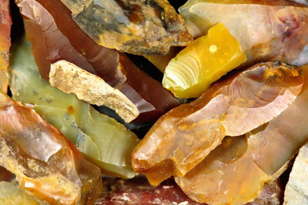
The rocks were subsequently described petrographically, using optical microscopy with reflected light. Additionally, selected materials were studied in thin-section. Our article presents a detailed description of lithic raw materials in the Federal State of Hesse and adjacent regions. Furthermore, it contains a diachronic overview of the importance of the respective rock types throughout history. The results of the study give interesting new insights into the formation and distribution of the mentioned raw materials. In combination with GIS-analyses, they contribute to a better understanding of subsistence strategies, mobility patterns, and social networks in the past.

Full paper: Hess, T. and Riede, F., 2022. The Occurrence of Lithic Raw Materials in the Western Part of Central Germany. Open Quaternary, 8(1), p.1. DOI: http://doi.org/10.5334/oq.108
Lay summary authored by Mathieu Duval and Julien Louys. Read the full paper here: http://doi.org/10.5334/oq.96
Our work results from a long-standing investigation initiated at the end of the XIX century by the Dutch Palaeoanthropologist M. Eugène F.T. Dubois. Before finding the famous fossil remains of Pithecanthropus (now Homo) erectus in Java, Dubois spent time on another Indonesian island, Sumatra, in the search of the missing link between apes and humans. His work led to the identification and excavation of several caves in the Padang Highlands.
More than 120 years later, the palaeontologist Julien Louys, working closely with Indonesian collaborators from the Institute of Technology in Bandung, and their team (co-authors of the present work) explored the highlands again, looking for the sites mentioned by Dubois in his field notes. This work, funded by the Australian Research Council, led to the (re-)discovery of the fossil deposits in Ngalau Sampit (“scary cave”), which was originally visited by Dubois in June 1888, and excavated about a year later.

In the present work, we provide the results of a multidisciplinary investigation of the fossil deposits undertaken over the last few years. They include a general mapping of the cave and the fossil-bearing chambers and passages, the identification of the fossils exposed at the surface of the breccia deposits, and some numerical dating results. To place our finds in historical context, and likely of interest to those examining human evolution from an historical point of view, we also provide a copy and detailed English translation of Dubois’s original notes on Ngalau Sampit, written at the end of the XIX century. In our study, we applied different dating methods (namely U-series, Electron Spin Resonance and Luminescence) in order to determine the age of the sediment and associated fossils found in the cave.
Our results yield an age of about 100,000 years for Ngalau Sampit, which makes the site of great significance for two main reasons: (i) there is currently no other fossil site in Sumatra with this age, but it is coeval with the oldest rainforest site in Java (Punung); (ii) the site is older than Lida Ajer Cave, another Sumatran site excavated by Dubois that has provided the earliest evidence of modern human in south-east Asia.
Full paper: Duval, M., Westaway, K., Zaim, J., Rizal, Y., Aswan, Puspaningrum, M.R., Trihascaryo, A., Albers, P.C.H., Smith, H.E., Drawhorn, G.M., Price, G.J. and Louys, J., 2021. New Chronological Constraints for the Late Pleistocene Fossil Assemblage and Associated Breccia from Ngalau Sampit, Sumatra. Open Quaternary, 7(1), p.9. DOI: http://doi.org/10.5334/oq.96
Lay summary authored by Hadi Jarahi. Read the full paper here: http://doi.org/10.5334/oq.94
I have done extensive research into the morphologic evidence of an ancient lake in Iran. The evidence was, in fact, the remains of the escarps located on the lake’s shore. The height of the escarps ranged from 1 m to 15 m and they were up to 45 km long. The common feature among all of them is that, along the stretches, they all follow specific topographic altitudes. As a result of the various cycles of transgression and regression of the lake, numerous escarps have been formed. In the satellite image, in particular, those dating back to 1970s, the escarps can be seen as white parallel narrow bands. My purpose is to discover the unknowns regarding this lake, and in doing so, I’d like to conduct more comprehensive research and focus on dating, to modeling the paleoclimatic and paleomorphologic conditions of the lake.

In my research, different water levels were investigated, and the major and minor altitudes were determined based on the sediment remains. Additionally, the materials of the sediment were examined. Currently, I am working on my second study on the paleogeography and paleomorphology of the lake. My findings have revealed surprising evidence for the effect of water erosion on the highlands, which were in fact islands in the lake. The drainage basin’s conditions and the amount of water in the lake were also evaluated, and it became clear that the lake contained almost 1.7 times as much water as is found in the Caspian Sea today. The approximate age of the lake puts it in the Younger Dryas. Obtaining more detailed information requires more comprehensive field studies and dating for different altitudes, which could enable us to make comments on the lake with a higher degree of certainty.
Full paper: Jarahi, H., 2021. Paleo Mega Lake of Rey Identification and Reconstruction of Quaternary Lake in Central Iran. Open Quaternary, 7(1), p.7. DOI: http://doi.org/10.5334/oq.94

